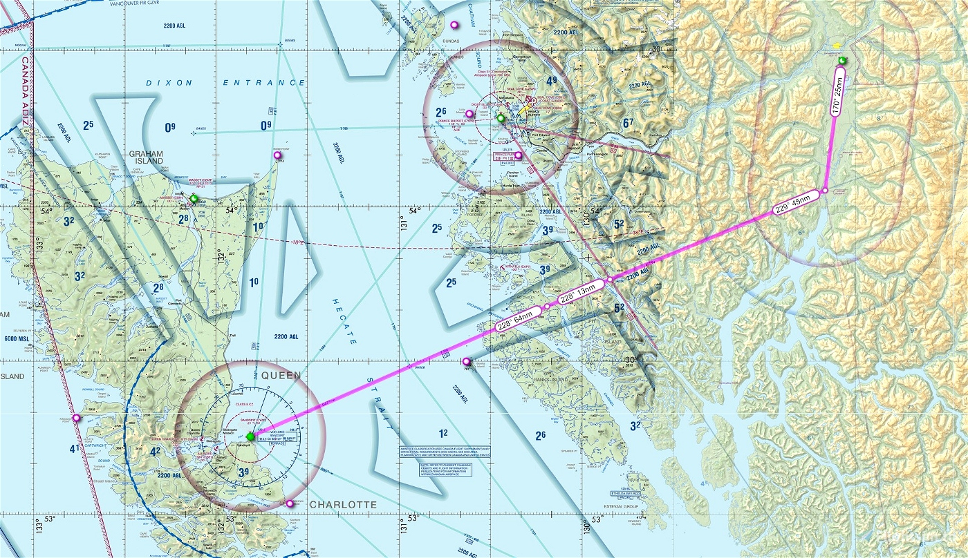
This is a VFR GPS flightplan route from Terrace BC CYXT to Sandspit BC CYZP
Flight distance is 147 nm.
The VFR flight is at 9500 feet. Sandspit elevation is 21 feet.
I've also included the IFR version of the plan which is flown at FL240. This would be great in an aircraft like the TBM. This area does get some really horrible weather in the fall and winter months, so it's always interesting. I presume you're using some program like navigraph, little navmap, or Foreflight to get your ATIS/METAR to choose your approach...And do make sure to familiarize yourself with the departure procedures out of Terrace (especially if departing north) because of all the high terrain in the area.
The route takes you out of the Kitimat Valley via the Kitimat beacon ZKI, then west over the rugged coastal mountains to open water and across to Sandspit on Haida Gwaii. Make sure you bring a floatation device if you have an engine failure.
Place the .pln files into your "localstate" folder (just a few back from community) then you can load the flight in from the bottom of the main map window in the sim.
Scenery for these airports is available on my webpage: genaiss.com/other-interests
Enjoy!

 deltasim59er


Doug, I'm really liking your flight plans in the area where I live and sim. Keep up the great work.
Another aging teen...
Daryl
3 years ago
haha aren't we all ageing teens lol? Thanks Daryl. I'm happy you're enjoying the flights. Cheers....Doug
3 years ago
deltasim59er
Cessna777
Just want you to know how much I enjoy flying these routes in my favorite part of the world!! You bring a lot of joy to an 82-year-old teenager!! Thanks so much!
3 years ago
You are so welcome. I do my best within the limitations of the software to make these as true to real-world flights as I can. So happy you enjoy them. Cheers...
Doug
3 years ago
deltasim59er
mauiguy