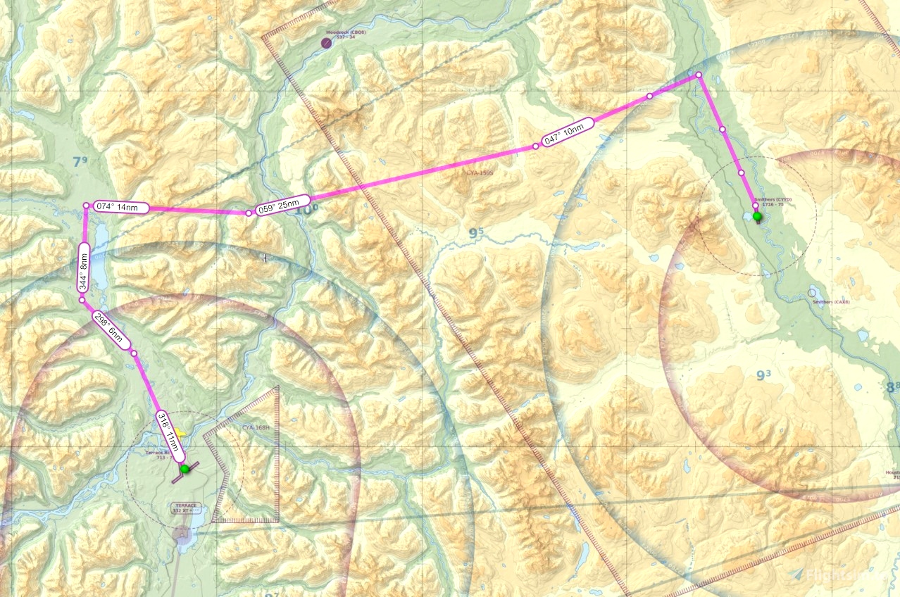
Here are 4 GPS IFR flightplans from Terrace BC CYXT to Smithers BC CYYD. The route is just over 90 miles flying distance.
Since the ATC in msfs is broken when flying in mountainous terrain, I decided to just make my own plans based on real-world Foreflight data. (ATC always asks you to descend below Minimum Safe Altitude before you're even established on the approach!)
I've included 4 different plans all named according to which departure runway and which arrival runway you want to use.
Sector Safe altitude is 11,100 feet.
I suggest you fly this route at 13000 feet.
For arrivals into Smithers runway 15:
- at WROTT at or above 8200'
- at IGSES at or above 6100'
- at DRESD at or above 4600'
- at LOMGO (your FAWP) start a 3 degree descent down to minimums 2380'
For arrivals into Smithers runway 33:
- at LESOL at or above 7200'
- at TETIR at or above 5900'
- at SELOT at or above 5000'
- at XONPU at or above 4200'
- at LIBIR (your FAWP) start a 3.33 degree descent down to minimums of 3260'
Smithers airport elevation is 1716'
Freeware scenery for these two airports is available on my webpage: genaiss.com/other-interests
Enjoy!

 deltasim59er


Hey Doug thanks for these great scenic flightplans over the Rockies. My dad, from Kitimat, flew this one for real during his pilot training course years ago, and he said it was both terrifying and awesome at the same time.
2 years ago
DeltaSierra